
As drone technology evolves, LiDAR-equipped drones are increasingly becoming the go-to choice for industries needing high-precision mapping and data collection. Whether it’s for construction, agriculture, or forestry, these drones provide accurate 3D mapping and topographic models that surpass traditional methods in both speed and detail. In this extended guide, we’ll take an in-depth look at some of the best LiDAR drones for sale, their capabilities, and the applications they’re best suited for.
Table of Contents
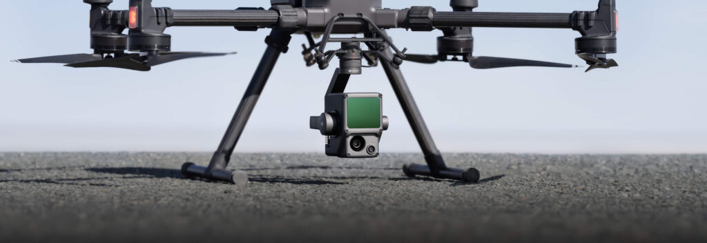
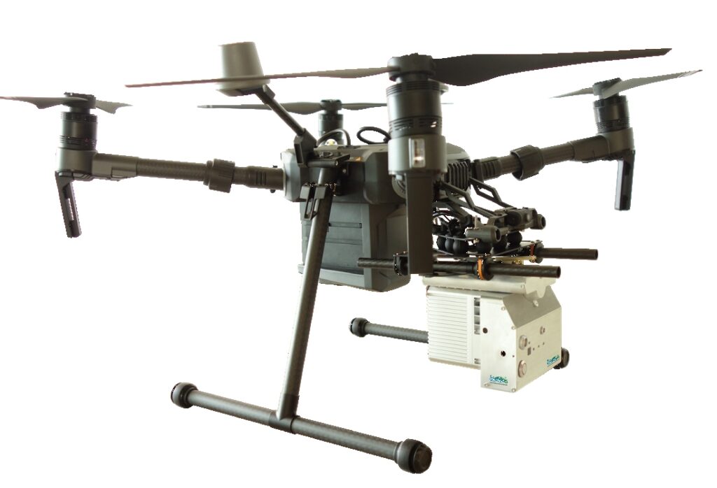
1. DJI Zenmuse L1
- Capabilities: DJI’s Zenmuse L1 is a comprehensive aerial LiDAR solution, integrating a Livox LiDAR module, a high-precision IMU, and a 20 MP RGB camera. This setup allows the drone to generate real-time 3D models with a point cloud accuracy of up to 5 cm, which is vital for highly detailed terrain mapping. One standout feature is its capability to operate in low-light and nighttime conditions, thanks to the high sensitivity of the integrated camera. It can generate colorized point clouds, which are a valuable asset in construction and urban planning.
- Key Applications: The Zenmuse L1 excels in construction site monitoring, topography, and infrastructure inspection, where accuracy and efficiency are paramount. Its integration with DJI’s Matrice 300 RTK makes it a robust solution for large-scale surveying and mapping.
2. Yellowscan Mapper
- Capabilities: The Yellowscan Mapper is a versatile, lightweight LiDAR system, well-suited for integration with various UAVs. It delivers high precision (2-5 cm accuracy) and offers the ability to scan difficult-to-access terrains. Its IP67 rating ensures that the equipment is weatherproof, making it ideal for use in rugged or challenging environments.
- Key Applications: It’s commonly used in topographical surveys, mining operations, and coastal monitoring. Its ability to penetrate dense vegetation also makes it ideal for forestry and environmental management, where accurate ground-level data beneath canopies is required.
3. RIEGL miniVUX-1UAV
- Capabilities: The RIEGL miniVUX-1UAV is renowned for its lightweight design and ability to collect high-density point clouds with exceptional accuracy. With a scanning range of up to 300 meters, this sensor captures minute details, making it perfect for complex terrain. Its 360-degree field of view ensures a comprehensive scan of surrounding environments.
- Key Applications: Widely used in agriculture, forestry, and environmental surveys, the miniVUX-1UAV excels in creating topographic maps in areas where dense vegetation is common. It’s also popular in disaster management scenarios, such as monitoring landslides or assessing flood risks.
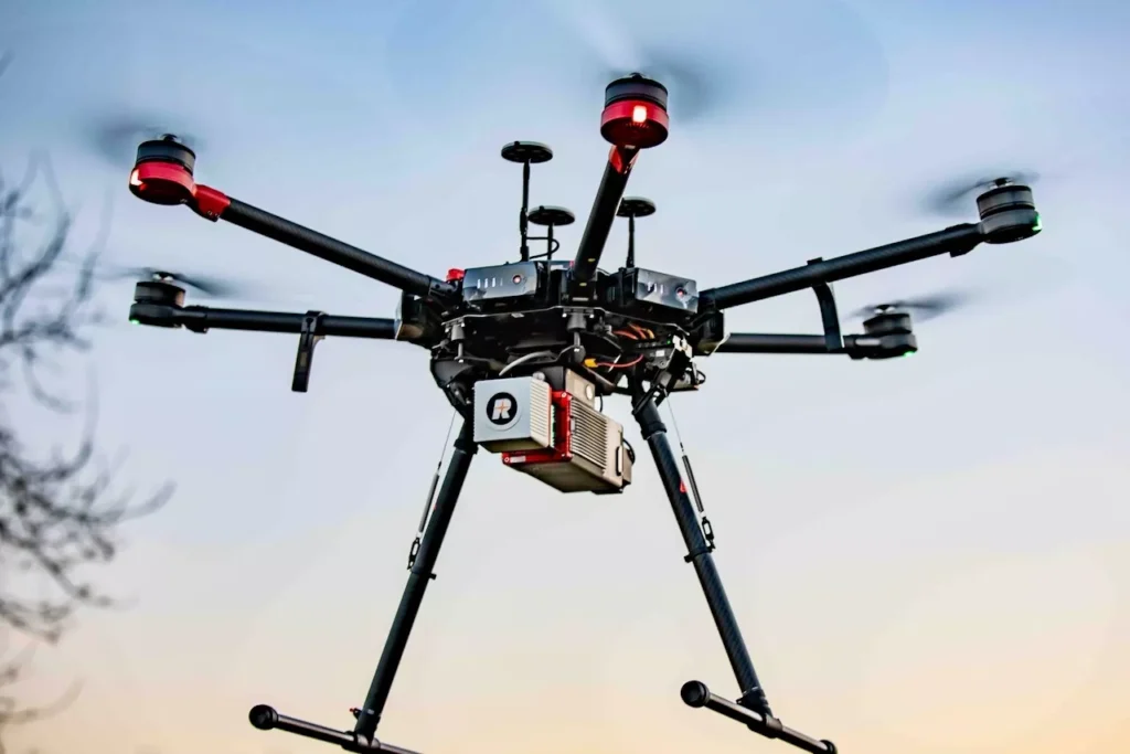
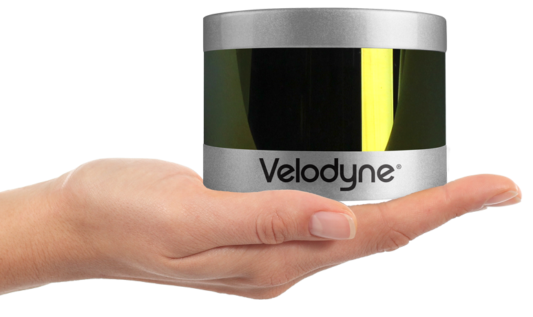
4. Velodyne Puck
- Capabilities: The Velodyne Puck offers a 360-degree field of view and is designed to capture up to 600,000 data points per second. It’s smaller and lighter than many other LiDAR sensors, making it suitable for various UAV platforms. Despite its compact size, it maintains high accuracy, which is crucial for applications that require real-time 3D data.
- Key Applications: Frequently used in urban mapping, infrastructure monitoring, and autonomous vehicle navigation, the Velodyne Puck is a flexible sensor for capturing detailed 3D models in urban or industrial areas. It’s especially useful in environments where real-time data is critical for decision-making, such as in construction projects or city planning.
5. LiAir V
- Capabilities: The LiAir V is known for its versatility and high performance in collecting high-resolution 3D point clouds. It has a wide scanning range and offers superior ground penetration, making it particularly useful for industries that require precise terrain mapping, even in densely vegetated or mountainous regions. Its compact design also makes it easy to deploy on various drones.
- Key Applications: The LiAir V is ideal for mining surveys, construction planning, and forest resource management, where quick and accurate data is required to assess large areas. It’s particularly effective at capturing ground elevation details and creating terrain models that inform infrastructure projects.
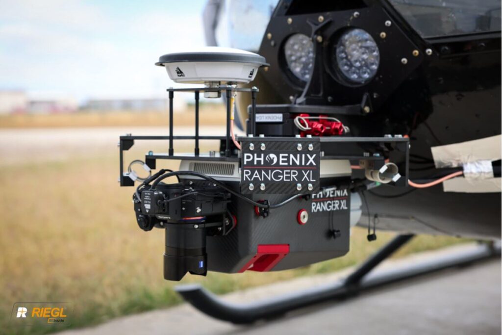
6. Phoenix LiDAR Systems Ranger-Lite
- Capabilities: The Phoenix LiDAR Ranger-Lite offers multi-echo laser scanning, allowing it to gather more comprehensive data in a single pass, especially in environments with dense vegetation or uneven ground. This LiDAR system supports a range of UAV platforms and produces high-density point clouds, making it a popular choice for those needing accurate terrain models and detailed feature extraction.
- Key Applications: Best suited for geological surveys, environmental research, and disaster response, the Ranger-Lite excels in projects where detailed mapping of complex environments is necessary. Its ability to create accurate 3D models of rugged terrain makes it indispensable for infrastructure development and emergency management.
Key Factors to Consider When Buying a LiDAR Drone
1. Accuracy
- If your work requires centimeter-level precision, drones like the DJI Zenmuse L1 and Yellowscan Mapper are ideal choices. These drones provide high-resolution point clouds necessary for surveying, urban planning, and infrastructure projects. Accuracy is especially critical in construction site monitoring, where even small errors in data could lead to costly mistakes.
2. Data Density
- For projects that require highly detailed 3D maps, data density is key. Drones equipped with sensors like the RIEGL miniVUX-1UAV and Phoenix Ranger-Lite offer high-density point clouds that are perfect for applications such as forestry and disaster management. In these fields, understanding every elevation change or terrain detail is vital for effective decision-making.
3. Integration and Flexibility
- Some LiDAR drones come with sensors integrated into a specific drone platform, while others, like the Velodyne Puck and Yellowscan Mapper, can be mounted on a variety of UAVs. This flexibility is crucial if you’re looking for a solution that can be adapted across different drone models. The DJI Zenmuse L1, for example, is designed to work specifically with the Matrice 300 RTK, making it a more integrated, out-of-the-box solution for construction or infrastructure professionals.
4. Environmental Adaptability
- Different environments demand different capabilities. The DJI Zenmuse L1 is highly effective in low-light conditions or areas with dense vegetation, making it suitable for use in forestry or archaeology. Meanwhile, drones like the Phoenix Ranger-Lite excel in rough terrains and can provide detailed maps even in challenging environments like mountainous areas or during natural disaster assessments.
5. Cost Considerations
- LiDAR drones can range from tens of thousands to over $100,000 depending on the sensor and drone system. Models like the LiAir V and Yellowscan Mapper offer a good balance between performance and affordability, while high-end models like the DJI Zenmuse L1 and RIEGL miniVUX-1UAV may be more suited for large-scale projects with bigger budgets. Always ensure the drone you choose aligns with your budget and project needs.
The Future of LiDAR Drones
- Improved Real-Time Processing: As on-board processing power improves, LiDAR drones will be able to deliver real-time data, allowing for faster decision-making and reducing the need for extensive post-flight processing.
- Longer Flight Times: Battery technology is improving, which means future LiDAR drones will offer extended flight times, allowing for more data collection in a single mission. This will be especially beneficial for large-scale surveying projects or remote area mapping.
- Increased Affordability: As the technology becomes more mainstream, the cost of LiDAR drones is expected to decrease, making them more accessible to small businesses and individual professionals who need precision mapping capabilities.
Conclusion
LiDAR drones are a game-changer for industries that rely on accurate geospatial data. Whether you’re in construction, forestry, agriculture, or infrastructure development, these drones provide the precision and efficiency needed to improve workflows and deliver high-quality results. By evaluating factors like accuracy, data density, environmental adaptability, and cost, you can find the right LiDAR drone to meet your project’s specific needs.
The future of LiDAR drones is bright, with innovations in real-time processing, longer flight times, and cost reductions on the horizon. As technology evolves, LiDAR drones will continue to play an essential role in improving how we map, monitor, and manage the world around us.
More from Drone-Gigs:
https://drone-gigs.com/bloghttps://drone-gigs.com/lidar-drone-technologyhttps://drone-gigs.com/dji-avata-vs-dji-neohttps://drone-gigs.com/best-drones-for-fishing-in-2024https://drone-gigs.com/why-the-dji-neo-could-be-the-best-budget-drone-of-2024https://drone-gigs.com/why-chinese-drones-are-dominatinghttps://drone-gigs.com/dji-neo-leakhttps://drone-gigs.com/dji-air-3s-leakhttps://drone-gigs.com/top-drone-camera-of-2024https://drone-gigs.com/drone-can-carry-how-much-weight-exploringhttps://drone-gigs.com/drone-can-follow-you-the-ultimate-guidehttps://drone-gigs.com/drone-can-fly-how-far-unveiling-the-mysteries-ofhttps://drone-gigs.com/top-5-beginner-drones-2024https://drone-gigs.com/guide-to-racing-drones-ultimatehttps://drone-gigs.com/is-drone-deploy-the-ultimate-solutionhttps://drone-gigs.com/unmatched-in-the-sky-the-dji-mini-4-prohttps://drone-gigs.com/drone-security-businesshttps://drone-gigs.com/environmental-drone-monitoring-navigating-the-skieshttps://drone-gigs.com/drone-assist-your-key-to-seamless-and-securehttps://drone-gigs.com/dji-avata-2-the-ultimate-review-and-in-depthhttps://drone-gigs.com/search-and-rescue-dronehttps://drone-gigs.com/drone-inspection-businesshttps://drone-gigs.com/top-drone-business-ideas-in-2024https://drone-gigs.com/autel-alpha-unveiled-the-ultimate-guidehttps://drone-gigs.com/agriculture-drone-business-in-2024https://drone-gigs.com/starting-a-drone-photography-businesshttps://drone-gigs.com/flying-2024-beginner-dronehttps://drone-gigs.com/dji-mavic-3-reviewedhttps://drone-gigs.com/drone-licence-requirements-worldwidehttps://drone-gigs.com/the-ultimate-guide-to-dji-droneshttps://drone-gigs.com/best-drone-video-editing-softwarehttps://drone-gigs.com/holy-stone-drones-features-performance-and-valuehttps://drone-gigs.com/mini-droneshttps://drone-gigs.com/parrot-dronehttps://drone-gigs.com/dji-mini-2-vs-mini-2-sehttps://drone-gigs.com/drone-insurance-options-2024

Pingback: The Shocking Truth: How One Drone Accident Almost Shut Down a Major UK Airport — Are We on the Verge of a Catastrophe? - Drone Gigs